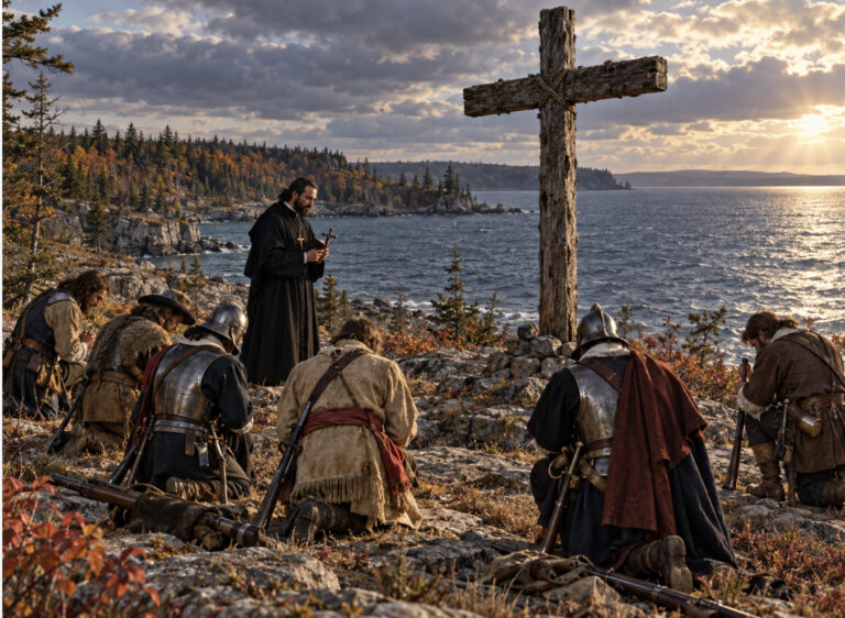
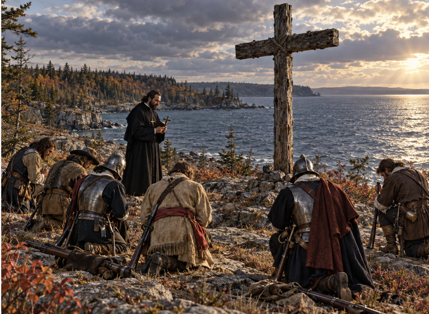
An artistic interpretation of what a seventeenth-century French expedition may have looked like along the eastern shore of Lake Ontario, with soldiers and voyageurs kneeling before a large wooden cross as a Jesuit missionary conducts prayers near what later became known as Dablon Point.
By Hans Wilder | The Watertown Post
Sometimes you stumble across a piece of Northern New York history that makes you realize just how ridiculously old this place really is. We have the ancient mounds around Perch Lake, reminders that people were living, traveling and building in this region long before Europeans ever showed up. We have Native trails and waterways that became the first transportation system of the North Country, followed by French explorers, Jesuit missionaries, fur traders, soldiers, forts and settlements that were here long before anybody was talking about the American Revolution.
Forget Victorian Watertown for a minute. Forget the War of 1812. Forget even the Revolution. We are talking about the days when Europeans were moving through the waters around what is now Jefferson County in wooden boats, carrying muskets, swords and religious crosses. This was the age of explorers, soldiers wearing steel helmets and breastplates, Jesuit priests in black robes, voyageurs paddling through unknown country and French flags appearing along waterways Native peoples had already traveled for generations.
Right in the middle of that story is a place outside Cape Vincent that most people today probably pass without giving it much thought: Dablon Point. Except Dablon Point was not always called Dablon Point. For generations it was known as Stony Point, a piece of land projecting into Lake Ontario between Wilson Bay and Mud Bay near Cape Vincent.
That is where this story can get confusing, because Jefferson County historically had two places called Stony Point. One is the better-known Stony Point farther south near Henderson. The other was near Cape Vincent, and that Stony Point was later renamed Dablon Point. History has a funny habit of doing that. Roads get renamed, bays get renamed, points get renamed, landmarks disappear from maps, and a generation or two later people forget what the old name ever referred to.
The history around Cape Vincent reaches back to at least 1615, when Samuel de Champlain and his expedition moved through the eastern Lake Ontario region. Think about that date for a second. That was five years before the Pilgrims landed at Plymouth Rock. Long before New York was New York, European explorers were already moving through the waters right outside our front door.
Then came the French missionaries. In 1655, Jesuit Fathers Claude Dablon and Pierre-Joseph-Marie Chaumonot traveled into what is now New York while establishing a mission among the Onondaga. Dablon’s travels put him directly into the Lake Ontario and St. Lawrence frontier surrounding what would centuries later become Cape Vincent.
This was not sightseeing. There was no Cape Vincent ferry, no Route 12E, no cottages lining the shoreline, no Clayton restaurants, no Thousand Islands Bridge and certainly no GPS telling Father Dablon to make a slight right in 400 feet. These guys were out there in wooden boats on open water, traveling through forests and Native trails, dealing with weather, wilderness and enormous distances with muskets, swords, priests carrying crosses and soldiers wearing the kind of helmets and armor that today look like they walked straight out of a movie.
Except this was not a movie. It happened here.
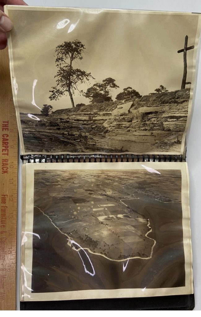
Nearly three centuries later, Northern New Yorkers decided that part of that history deserved to be remembered. In 1939, a monument was dedicated at the old Stony Point near Cape Vincent commemorating Father Dablon. Historic photographs from that dedication show something particularly impressive: an enormous wooden cross standing beside Lake Ontario, mounted above a stone base and overlooking the water.
The following year, the name change became official. Federal correspondence published in 1941 records that the old name Stony Point was changed to Dablon Point, following action by the New York State Committee on Geographic Names. The federal government subsequently adopted Dablon Point for the headland between Wilson Bay and Mud Bay.
There is also a great Watertown connection to the story. The effort was undertaken on behalf of a local group headed by Matthew D. Long of 1212 State Street in Watertown, who owned much of the point and permitted the monument honoring Dablon to be erected there.
So where did we rediscover all of this? Believe it or not, eBay.
An extraordinary original 1939 photographic album titled Dablon Point Cape Vincent NY 1939 is being offered for sale online. It contains photographs of the property, the dedication ceremony, the giant wooden cross, newspaper material and documentation connected with the commemoration of Father Dablon. It is a remarkable little collection of Jefferson County history that somehow survived nearly 90 years and wound up on eBay. Anyone interested in owning a genuine piece of Northern New York history might want to take a look while it is still available.
That album also helps clear up one part of an old local story while opening another mystery. There has long been a story about a great wooden cross somewhere around Stony Point that could supposedly be seen from the lake by travelers emerging from the St. Lawrence River into Lake Ontario.
At first glance, you might assume the story referred to the famous enormous cross Father Louis Hennepin erected at Fort Frontenac, today’s Kingston, during the French period. But geographically, that has always bothered us. Fort Frontenac sits back around Kingston, surrounded by the complicated approaches, islands and shoreline of the upper St. Lawrence. A cross visible from the open lake after coming through the St. Lawrence sounds much more like something standing on an exposed American headland.
Then the old names start becoming important. There really was another Stony Point near Cape Vincent. It was the place that later became Dablon Point. And there really was a giant wooden cross standing there.
That does not mean we have proven that the cross itself dated to the 1600s. The cross visible in the surviving photographs appears to be the 1939 commemorative cross, erected in connection with honoring Father Dablon. We have not yet found documentary proof that it replaced an earlier wooden cross erected there by Dablon or another French explorer.
That distinction matters, but the old story suddenly does not sound quite so crazy either. The location is real. The old Stony Point name is real. Dablon’s connection to the seventeenth-century frontier is real. The giant wooden cross is real. The tradition of French missionaries and explorers erecting large wooden crosses during their travels is real. Whether an earlier cross once stood on that same point is the part of the puzzle we are still chasing.
And that is exactly what makes local history fun. Sometimes history is not sitting nicely cataloged behind glass in a museum. Sometimes it is buried in an old newspaper clipping. Sometimes it is sitting in a family photo album. Sometimes it is hidden in an old geographic name that disappeared from maps generations ago. Sometimes it is buried in ancient earthworks near Perch Lake. And sometimes the evidence turns up for sale on eBay.
What makes this story especially fascinating is the perspective it gives us about Northern New York. We tend to think our history begins with Sackets Harbor, Fort Drum, the War of 1812 or the settlement of Watertown. Not even close. Human history here goes back thousands of years, and European history around eastern Lake Ontario was already unfolding more than 400 years ago.
Champlain was moving through these waters in 1615. French missionaries were traveling through the region in the 1650s. France and England were competing for trade, territory and influence. Native nations controlled enormous networks of trails, settlements and waterways. Lake Ontario and the St. Lawrence were not the edge of nowhere. They were the highways of North America.
Those waters outside Cape Vincent that today carry fishing boats, sailboats and tourists once carried explorers entering a continent Europeans barely understood. So the next time you hear the name Dablon Point, remember that you are not looking at some subdivision name dreamed up by a developer. You are looking at a surviving geographic reminder of the 1600s, and at a place that once carried another name entirely.
That is one of the great things about Northern New York history. The names change. The maps change. The landmarks disappear. Sometimes there are even two places with the same name, as there were with the two Stony Points in Jefferson County. But underneath all of that is a much older story involving wooden boats, muskets, priests, explorers, wilderness forts, giant crosses and, yes, some pretty cool-looking dudes running around in helmets and armor.
Northern New York has been sitting in the middle of the North American story for a very long time.
We just have a habit of forgetting it.

https://www.ebay.com/itm/305350981438
About the Author